Saturday, October 9, 2021

Claims to Land in Missouri and the Second Board of Commissioners

The courts as a means for the final settlement of the as yet unconfirmed private land claims in Missouri had not proven to be satisfactory for the claimants. In January 1831 the General Assembly of Missouri had sent a memorial to Congress, recommending the creation of a board of land commissioners endowed with sufficient powers to achieve full and final justice between the government and these claimants. They believed that such a tribunal should “adopt as its rule of action, to confirm every claim which the government of either Spain or France would have confirmed had no transfer of the territory been made ” (ASP:PL Vol. 6, pg 300).

Since the General Assembly of Missouri kept demanding it and the Committee on Private Land Claims in the U. S. Senate had recommended it in 1828, Congress passed the Act of July 9, 1832, chapter 180, An Act for the final adjustment of private land claims in Missouri (U. S. Statutes at Large, Vol. 4, pg 565). The President of the United States was to appoint two commissioners to join the recorder of land titles in Missouri in examining all the unconfirmed private claims that had already been filed in the recorder’s office. The examination was limited to those claims founded upon any incomplete grant, concession, warrant or order of survey that had been issued by the authority of France or Spain prior to March 10, 1804. They were permitted to receive additional testimony, but it had to be taken within twelve months of the passage of the act.

The recorder and commissioners were to segregate the claims examined into two classes. The first class was to include those claims that they believed would have been confirmed according to the laws, usages and customs of the Spanish government and the practice of the Spanish authorities at New Orleans, if the government under which those claims originated had continued in Missouri. The second class was to include those claims that they believed were destitute of merit, in law or equity, under the same laws, usages, customs and practice of the Spanish authorities. They were also to provide an explanation of their reasoning in each case.

Once this second board of commissioners had organized, the office of the recorder was to be open for the purposes of the examination for two years and no longer. They were to proceed in a summary manner, with or without any new application from the claimants. During the term of their examination and at the commencement of each session of Congress, they were to send a report to the Commissioner of the General Land Office, detailing their opinions on the claims so far examined. The report would be forwarded to Congress for the final decision upon the claims of the first class.

After the final report was submitted by the recorder and commissioners, those claims falling into the second class, being destitute of merit, were to be subject to sale along with the other public lands. Those claims falling into the first class were to be further reserved from sale until Congress rendered a final decision. Any claim that was ultimately rejected by Congress was subject to sale along with the other public lands. An actual settler whose claim was ultimately rejected or any claimant who chose to waive his claim was granted the right of pre-emption to the land encompassing the improvements up to the quantity of their claim, but not exceeding 640 acres.

Andrew Jackson, President of the United States, nominated Doctor Lewis F. Linn of Sainte Genevieve, Missouri and Wilkins Updyke of Rhode Island to serve as commissioners with recorder of land titles Frederick R. Conway. The U.S. Senate confirmed the appointments of Linn and Updyke on July 14, 1832 (Senate Executive Journal, Vol. 4, pg 277). The second board of commissioners was organized on October 1, 1832 (ASP:PL Vol. 8, pg 923), but Updyke resigned shortly thereafter, leaving Conway and Linn to continue taking testimony until a replacement could be confirmed. To further hinder the board’s progress, the Asiatic cholera swept into Missouri, so that many claimants and witnesses were unable to appear before the board to present their testimony. Thus, no report could be made the first year (ASP:PL Vol. 8, pg 22).

On November 19, 1832 recorder Conway and commissioner Linn wrote to the Commissioner of the General Land Office, recommending that the Act of July 9, 1832, chapter 180, be amended in two ways so as to accomplish a truly final settlement of all the claims that could possibly be brought forward. First, they believed that the act should be extended to include claims founded on written grants, concessions, warrants or orders of survey that had not previously been filed in the office of the recorder of land titles, but which might have been submitted to the district court of the United States for Missouri. Second, they believed the act should be extended to include claims based on settlement and cultivation that had previously been submitted and rejected under other acts of Congress (ASP:PL Vol. 6, pg 516).

Congress responded by passing the Act of March 2, 1833, chapter 84, An Act supplemental to the act entitled “An act for the final adjustment of land claims in Missouri” (U. S. Statutes at Large, Vol. 4, pg 661), extending the provisions and restrictions of the previous act to every claim based on settlement and cultivation. Additional testimony for these claims was allowed to be taken for two years from the date of the original act.

President Jackson nominated Albert G. Harrison of Missouri on December 31, 1832 to fill the vacancy left by the resignation of Wilkins Updyke. The U.S. Senate confirmed the appointment of Harrison on January 8, 1833 (Senate Executive Journal, Vol. 4, pg 291, 296).

Before commencing examination of the claims before them, Conway, Linn and Harrison resolved to settle the general principles that would serve as a guide for the decisions they were to make. They reviewed all of the pertinent Acts of Congress, consulted the available compilations of French and Spanish laws and considered the decisions of the United States Supreme Court that had been made up to that time (ASP:PL Vol. 6, pg 703).

On October 30, 1833 they passed a resolution adopting the following guiding principles (ASP:PL Vol. 6, pg 710):

1st. That it was the custom of both France and Spain, and formed a part of the policy of those nations in the settling of new countries, to appoint officers, whose business it was, by express regulations, to grant lands to all such of their subjects as might wish to settle in those countries, for the avowed purposes of improving and populating said countries.

2d. That all acts in relation to grants, concessions, warrants, and orders of survey, done and performed by the French and Spanish officers during the time those governments had possession of and exercised the sovereignty over the province of Upper Louisiana, ought to be considered as prima facie evidence of their right to do those acts and perform those duties, and ought to be held and considered binding on the government of the United States, inasmuch as the acts of the officers in said province were not only tolerated but approved by their superiors in power.

3d. That all grants, concessions, warrants, or orders of survey, made and issued by the French or Spanish officers in the late province of Upper Louisiana on or before the 10th day of March, 1804, where the same are not proved to be fraudulent, ought to be confirmed, provided the conditions annexed to the grant have been complied with, or a satisfactory reason given for not fulfilling the same.

4th. That O’Reily’s instructions or regulations of 18th February, 1770, those of Gayoso of 9th September, 1797, and those of Morales of 17th July, 1799, were not in force in Upper Louisiana, except, perhaps, the provisions contained in those of Gayoso, which related to new settlers.

5th. That sub-delegates, in making grants, &c., were not limited by any known law or custom as to the quantity of arpents they should grant, except, perhaps, as to new settlers, and that such grants passed title, and that a survey was merely an incidental matter after the title had passed by the grant, so as to identify the land, that the grantee might take possession of it.

6th. That what are called incomplete grants by the custom and practice of the country were recognized as property capable of passing by devise, transferable from one to another, and were liable to be sold for debt.

7th. That those grants which are general in their terms pass as good a title as those which are more special, the difference being in the description of the land, and not in the title.

8th. That those officers of the French and Spanish governments whose names are signed to concessions must be presumed to have acted agreeably to powers vested in them by their sovereign, and that their acts are accordingly legal until the contrary is shown.

9th. That fraud is an affirmative charge, and, as relates to the French and Spanish claims, as well as in all other cases, must be proved, and not presumed.

10th. That in all cases where there are conditions to a grant, &c., if the grantee shows satisfactorily that he has been prevented from a fulfillment of the conditions by the act of God, by the act of law, by the enemies of the country, or by the act of the party making the grant, or any other sufficient cause, the grantee will be considered as absolved from the performance of the same, and the grant regarded as absolute.

The second board of commissioners submitted their first report of claims of the first class, dated November 27, 1833, to the Commissioner of the General Land Office, who then forwarded the report to the U.S. Senate on January 18, 1834 (ASP:PL Vol. 6, pg 703). The report contained decisions numbered 1 through 142 that the recorder and commissioners recommended for confirmation.

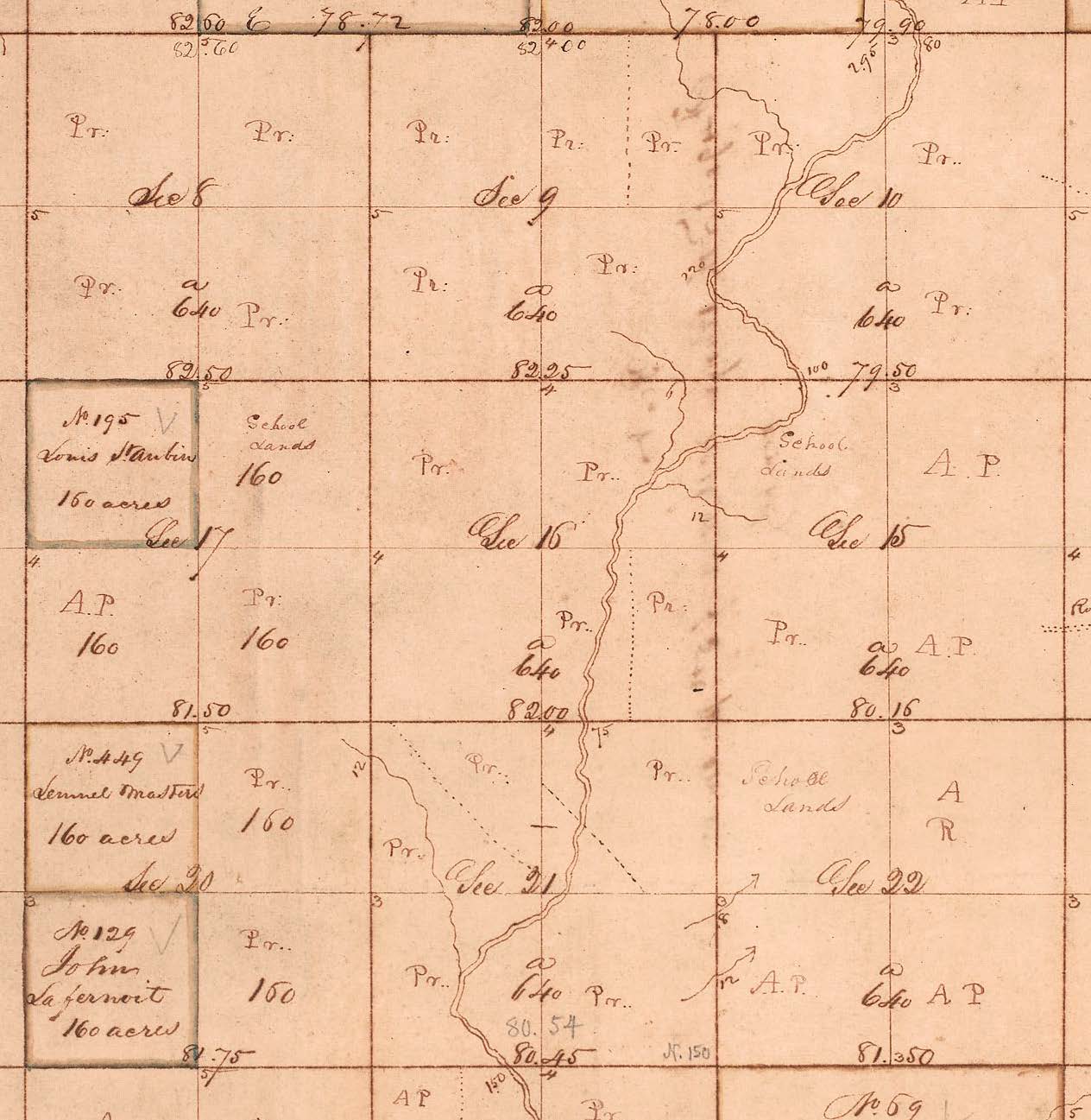
David Delaunay's claim to 800 arpents was recommended for confirmation by the second board of commissioners as Decision No. 5 of the first class. When surveyed as General Series Survey No. 3128 in Township 41 North, Range 3 East, it was found to interfere with settlement claims previously confirmed by the board of revision. Parts of it had also already been sold by the United States government as indicated by the red letter "S".
(courtesy of the Missouri State Land Survey)

In June 1833 Alexander Buckner, U. S. Senator for Missouri, along with his wife succumbed to the cholera and died. Missouri Governor Daniel Dunklin appointed Dr. Linn to fill the vacancy (Linn and Sargent, pg 78, 129). By the time the first report of the second board of commissioners was submitted to Congress, Dr. Linn had already joined the U. S. Senate. Dr. Linn would eventually end up on the Committee for Private Land Claims.

Albert Harrison resigned as commissioner to the second board and was elected to the U. S. House of Representatives. The second board then having two vacancies could not proceed with its business until those vacancies were filled.

President Jackson nominated James S. Mayfield on February 3, 1834 to replace Dr. Linn (Senate Executive Journal, Vol. 4, pg 347) and he nominated Dr. James H. Relfe on April 8, 1834 to replace Harrison (Senate Executive Journal, Vol. 4, pg 390). The nomination of Mayfield was referred to the Committee on Public Lands in the U. S. Senate and was not approved until April 24, 1834 (Senate Executive Journal, Vol. 4, pg 392). Relfe was approved by the Senate on May 1, 1834 (Senate Executive Journal, Vol. 4, pg 398).

The next iteration of the second board of commissioners with Conway, Mayfield and Relfe resumed the examination of land claims in June 1834. They submitted the second report of claims of the first class, dated December 5, 1834, to the Commissioner of the General Land Office, who then forwarded the report to the U.S. Senate on January 7, 1835 (ASP:PL Vol. 7, pg 773). The report contained decisions numbered 143 through 255 (113 claims) that the recorder and commissioners recommended for confirmation.

John Hand's claim to 300 arpents and John Taylor's claim to 481 acres 8 poles were recommended for confirmation by the second board of commissioners as Decision Nos. 214 and 281, respectively, of the first class. When surveyed as General Series Survey Nos. 3148 and 3147 in Township 31 North, Range 13 East, they were found to interfere with the settlement claim of William Hand, which had been previously confirmed by the Act of April 29, 1816. Part of Survey No. 3148 had already been sold by the United States government as indicated by the red letter "S".
(courtesy of the Missouri State Land Survey)

At some point early in 1835 James Mayfield was removed from the second board of commissioners. President Jackson nominated Falkland H. Martin on March 3, 1835 to replace him and the U. S. Senate approved the appointment the same day (Senate Executive Journal, Vol. 4, pg 483, 484).

The board was approaching a deadline set by the Act of July 9, 1832, chapter 180, so recorder Conway and commissioner Relfe continued the examination of claims until Martin joined them sometime around August 1835. The final reports of the second board of commissioners, dated September 30, 1835, were sent to the Commissioner of the General Land Office, who then forwarded the reports to the U.S. Senate on December 10, 1835 (ASP:PL Vol. 8, pg 20). The third report of claims of the first class contained decisions numbered 256 through 345 (90 claims) that the recorder and commissioners recommended for confirmation. The report of claims of the second class, being claims considered destitute of merit, contained decisions numbered 1 through 152.

The board further reported that they were not able to complete the investigation of all the claims that they were authorized to examine. There were about seven hundred (700) claims in the State of Missouri that remained unexamined. The board earnestly recommended to Congress that the investigations should continue until the business was finally completed. If Congress should pass an act for that purpose, the board estimated that the work could be completed in another two years (ASP:PL Vol. 8, pg 22).

Congress scrutinized the reports of the recorder and commissioners, particularly questioning the validity of the principles used by them in making their determinations. Congress requested opinions and arguments from the Secretary of the Treasury and the Commissioner of the General Land Office, who further called upon the Attorney General of the United States, who deferred to the legal counsel for the United States that had been arguing the similar cases from Florida in the United States Supreme Court (ASP:PL Vol. 7, pg 581, Vol. 8, pg 789). A thorough examination of the facts was pursued.

When Congress was finally satisfied, they passed the Act of July 4, 1836, chapter 361, An Act confirming claims to land in the State of Missouri, and for other purposes (U. S. Statutes at Large, Vol. 5, pg 126). This act confirmed all of the claims recommended for approval by the recorder and commissioners. However, twenty-nine (29) claims were explicitly excluded from confirmation. Any adverse claimants were reserved the right to assert the validity of their claims in a court or courts of justice.

By that time it was entirely possible that all or part of the lands confirmed by this act had already been sold or claimed by someone else under some other law of the United States. If that was the case, no title was conferred by this act to those lands. An equivalent amount of land was permitted to be located on any unappropriated land of the United States within the same state or territory. The new locations were to conform to legal divisions and subdivisions.

Francois Normandeau's claim to 2500 arpents was recommended for confirmation by the second board of commissioners as Decision No. 97 of the first class. When surveyed as General Series Survey No. 3239 in Township 56 North, Range 5 West, it was found to interfere with the claim of Mathurin Bouvet and Charles Gratiot. Nearly all of it had already been sold by the United States government as indicated by the red letter "S".
(courtesy of the Missouri State Land Survey)

SOURCES

American State Papers: Public Lands (ASP:PL)

Linn, E. A. and Sargent, N., The Life and Public Services of Dr. Lewis F. Linn, for Ten Years a Senator of the United States from the State of Missouri, 1857

Senate Executive Journal

U. S. Statutes at Large


----------------------------------------
original composition by Steven E. Weible

Friday, July 9, 2021

Claims to Land and the District Court of Missouri

Congress had passed its “Act for the final adjustment of land titles ... in the territory of Missouri ” on April 12, 1814, chapter 52 (U. S. Statutes at Large, Vol. 3, pg 121), and the opinions of the recorder of land titles had been confirmed by the Act of April 29, 1816, chapter 159 (U. S. Statutes at Large, Vol. 3, pg 328). The business was finally finished ... except that it wasn’t.

John Scott, the delegate of the Territory of Missouri to the U.S. House of Representatives, wrote to Josiah Meigs, the Commissioner of the General Land Office, on January 27, 1817, expressing the hope “that Government will again at a proper time give to those people whose claims are thus rejected another opportunity to perfect their titles, and I even indulge the hope that provisions will be made to embrace claims that have never been notified, or filed with the Commissioners or recorder “ (Territorial Papers, Vol. 15, pg 238). Meigs responded on January 30, 1817 that “I cannot agree with you in the Idea that a door should be opened for more claims, I think the Govt have been liberal, very liberal, both in time & conditions “ (Territorial Papers, Vol. 15, pg 239).

Meanwhile, the U.S. House of Representatives had been inundated with memorials and petitions regarding the unconfirmed land claims in the Territory of Missouri. On April 16, 1818 the House passed a resolution instructing the Secretary of the Treasury, William H. Crawford, to draft a plan for their final adjustment and settlement (ASP:PL Vol. 3, pg 348).

On April 30, 1818 the President announced by proclamation the first sales of the public lands in the Territory of Missouri (Territorial Papers, Vol. 15, pg 385). John Scott promptly wrote to Secretary Crawford on May 5, 1818, requesting that directions be given to the register and receiver of each land office to withhold from sale those private claims that had previously been examined, but not confirmed (Territorial Papers, Vol. 15, pg 388). Secretary Crawford referred the request to Josiah Meigs, who responded on May 11, 1818, stating that he considered the unconfirmed claims as invalid and subject to sale (Territorial Papers, Vol. 15, pg 391).

Secretary Crawford was still working on the plan requested by the House of Representatives, so he wrote to Josiah Meigs on June 10, 1818, directing him to have the recorder of land titles in the Territory of Missouri furnish descriptive lists of the unconfirmed claims to the register and receiver of the land offices at St. Louis and Franklin, where sales of the public lands had been authorized. These unconfirmed claims were to be withheld from sale for the time being (Territorial Papers, Vol. 15, pg 399).

Samuel Hammond, the receiver at the land office in St. Louis, reported to Josiah Meigs on July 20, 1818 that the recorder of land titles, Frederick Bates, had furnished a list of the unconfirmed claims, but the information was not sufficient to determine actual locations on the township plat (Territorial Papers, Vol. 15, pg 419). In June 1818 Frederick Bates had complained to Meigs that it would be impossible for him to give specific descriptions, since he had no connected plat (Territorial Papers, Vol. 15, pg 401). William Rector, by then the Surveyor of Public Lands in the territories of Missouri and Illinois (Territorial Papers, Vol. 17, pg 332), suggested having the Deputy Surveyors make some connection to the unconfirmed claims while in the field, so that they could be represented on the township plat (Territorial Papers, Vol. 15, pg 402). In August 1818 Josiah Meigs informed Rector that there was no provision for surveying the unconfirmed claims. He had supposed that a reservation of a right angled tract of the appropriate quantity in the correct vicinity would be sufficient (Territorial Papers, Vol. 15, pg 422). This uncertainty of location, however, cast some doubt on what lands could actually be sold (Territorial Papers, Vol. 15, pg 419, 427).

In December 1818 Secretary Crawford submitted his plan to the House of Representatives for the final adjustment and settlement of the unconfirmed claims. He noted that “it is conceived to be extremely improbable that there should be, at this time, any considerable number of claims entitled to the liberality of the Government, which have not yet been submitted to either of the different tribunals that have, from time to time, been constituted for that purpose ... Considering, then, that the titles to lands ... in the Missouri Territory, so far as they are derived from, or dependant upon, any act of Congress, are correctly and finally settled, nothing more is necessary than to prescribe a rule by which the validity of titles, not dependant upon the acts of Congress, may be promptly and legally determined.” He then presented a draft bill that would allow anyone with an unconfirmed private claim to present their case to the district court (ASP:PL Vol. 3, pg 348).

In January 1819 Congress was presented with a memorial from the General Assembly of the Territory of Missouri, urging the enactment of comprehensive legislation that would ensure final justice once and for all to those unconfirmed claims that had originated under the French and Spanish governments (Territorial Papers, Vol. 15, pg 489).

The U.S. House of Representatives took further time to examine the matter, including the instructions given by the Secretary of the Treasury to the Board of Commissioners in 1806 (ASP:PL Vol. 3, pg 355) and the Spanish regulations for granting lands issued by Alexander O’Reilly in 1770, Manuel Gayoso de Lemos in 1797 and Juan Ventura Morales in 1799 (ASP:PL Vol. 3, p 432 and Vol. 4, pg 3). At the conclusion of their examination Congress passed the Act of May 26, 1824, chapter 173, An Act enabling the claimants to lands within the limits of the state of Missouri and territory of Arkansas to institute proceedings to try the validity of their claims (U. S. Statutes at Large, Vol. 4, pg 52).

(The Territory of Arkansas was created as an entity separate from the Territory of Missouri by the Act of March 2, 1819, chapter 49 (U. S. Statutes at Large, Vol. 3, pg 493). The admission of the State of Missouri into the Union of the United States of America was declared complete by proclamation of President James Monroe on August 10, 1821 (U. S. Statutes at Large, Vol. 3, pg 797).)

Section one of the act permitted any person or persons, or their legal representatives, to petition the district court of the State of Missouri to examine the facts and to decide the validity of their claim to land. The act was intended to apply to those claims that were protected by the treaty between the United States of America and the French Republic, dated April 30, 1803, and to which complete titles would have been perfected had the Province of Louisiana not been transferred to the United States. That is, “any French or Spanish grant, concession, warrant, or order of survey, legally made, granted, or issued, before the tenth day of March, one thousand eight hundred and four, by the proper authorities.

Section two of the act directed that the proceedings for each petition were to be conducted according to the rules of a court of equity. The district court was to have the full power and authority to settle the question of validity of title for each claim. The judgment or decree of the district court was to be final and conclusive, unless appealed to the Supreme Court of the United States within one year. The decision of the Supreme Court would then be final and conclusive.

Section five of the act allowed claimants two years from the passage of the act to bring their petitions before the district court. If by reason of neglect or delay by the claimant the case was not prosecuted to a final decision within three years, the claim was to be barred from further action in any court.

Section seven of the act declared that any claim finally denied by the court or barred from further action in any court was to become a part of the public lands of the United States.

If the court decided in favor of the claimant and against the United States and the claim exceeded one thousand acres, section nine of the act required the attorney of the United States for the district to notify the attorney general of the United States. If the attorney general considered the decision of the district court to be in error, he was to direct that an appeal be made to the Supreme Court of the United States. He was then responsible for prosecuting the appeal.

If a claimant was successful in validating his claim in the district court or Supreme Court and all or part of the claim had already been sold by the United States, section eleven of the act permitted the claimant to select from the public lands a like quantity in parcels conformable to sectional divisions and subdivisions in any land office of the state of Missouri. If the total quantity of land to be selected was not conformable to the smallest sectional subdivisions authorized for sale, the claimant was permitted to purchase at the rate of one dollar and twenty-five cents per acre the additional quantity of land to make one half quarter section.

For the convenience of petitioners section twelve of the act required the judge of the district court to hold sessions at St. Louis, Sainte Genevieve and Jackson. Section twelve also specifically excluded from the provisions of this act a claim of the representatives or assignees of Jacques Clamorgan, deceased, to a tract of land lying between the Missouri River and Mississippi River and covering parts of St. Charles County and Lincoln County.

Section fourteen of the act extended the provisions of the act to the territory of Arkansas in which the superior court of the territory would have jurisdiction.

The Act of May 22, 1826, chapter 157, An Act for the relief of Phinehas Underwood, and for other purposes (U. S. Statutes at Large, Vol. 6, pg 355), extended the time for filing petitions until May 26, 1828.

Claimants who had been anxiously awaiting this opportunity rushed to file their petitions. The first case was taken up in November 1824, but by February 1828 only three cases had been prosecuted to a final decision. All three had failed. Two of the cases had been appealed to the U.S. Supreme Court, but were still waiting to be heard. These disappointing results, accompanied by the expense and delay of the court proceedings, dampened the initial enthusiasm. Rather than fail in court and be barred from further consideration, some chose to withdraw their petitions, while others were discouraged from filing at all. Thus, the remedy was not as satisfactory as the claimants had hoped. A petition was sent to Congress from citizens of the State of Missouri, requesting an amendment that would secure to them the final confirmation of their claims. If that could not be done, they at least needed another two year extension of the deadline for filing a petition with the district court. The outcome of the first appeal to the Supreme Court, which had yet to be heard, would influence any decision to press on in the courts (ASP:PL Vol. 5, pg 458).

The General Assembly of the State of Missouri sent a memorial to Congress in January 1827, urging the passage of an amendment to the law that would result in a speedy and final determination of the claims not yet confirmed. They suggested the formation of a new board of commissioners to further investigate the unconfirmed claims and to examine claims that had not yet been considered. At the very least, they urged that the right of preference to purchase be given to those whose claims were ultimately denied, so that they could purchase the land encompassing their improvements (ASP:PL Vol. 4, pg 880).

The State of Missouri and Territory of Arkansas were not alone in grappling with this issue of unconfirmed claims that had originated from some other entity than the United States. The States of Louisiana, Illinois, Mississippi and Alabama and the Territories of Florida and Michigan were dealing with similar issues with unconfirmed private claims that had originated from Great Britain, France and Spain. To address these unresolved issues the Committee on Private Land Claims in the U.S. Senate was tasked with examining the facts and recommending a solution for the trial and decision of these claims to land. The Committee reported to the Senate on January 9, 1828, suggesting two possible alternatives (ASP:PL Vol. 5, pg 350).

The first alternative was for the United States to sell the land covered by the unconfirmed claims subject to the claims of individuals. The claimants would then be left to litigate their claim with the purchaser. Although this was an alternative, the Committee recognized that it was not a good one, since it may only serve as a relinquishment of interest without any certainty of title. This would not be a favorable outcome for the claimant, the purchaser or the government.

The second alternative was to establish a special tribunal for the trial and decision of the yet unconfirmed private claims. The Committee suggested that the tribunal’s sessions should be conducted in the City of Washington, where the public records were kept and where competent agents were available to represent the rights of the claimants. The Committee felt that this alternative would “best promote the interests of the public, while it will effectually protect the just rights of the claimants.

The time allowed for claimants to obtain a final decision in the district court was extended to May 26, 1830 by the Act of May 24, 1828, chapter 90, An Act to continue in force for a limited time, and to amend an act entitled “An act to enable claimants to lands within the limits of the state of Missouri and territory of Arkansas, to institute proceedings to try the validity of their claims” (U. S. Statutes at Large, Vol. 4, pg 298). Section two of the act stated that a confirmation by the court served only as a relinquishment of title by the United States and did not impair any adverse claim. Section three of the act permitted those whose claim was ultimately rejected by the court and who were actual inhabitants and cultivators of the soil to claim the right of pre-emption at the minimum price for public lands for the land covered by their improvements within the limits of the rejected claim.

It appears that there were only three claims confirmed by the court of the United States for the district of Missouri. These included an island in the Missouri River claimed by John Mullanphy under Joseph Lapierre and Joseph Aubuchon (General Series Survey # 3085), a tract of 500 arpents claimed by Daniel Dunklin and John Jones under Amable Partenay (General Series Survey # 3310) and a tract of 406 arpents claimed by John Baptiste Placet (General Series Survey # 3311).

General Series Survey # 3085 in Township 47 North, Range 6 East
was confirmed by the U. S. Court for the district of Missouri
(courtesy of the Missouri State Land Survey)

General Series Survey #s 3310 and 3311 in Township 37 North, Range 2 East
were confirmed by the U. S. Court for the district of Missouri
(courtesy of the Missouri State Land Survey)

The first appeals to come to the United States Supreme Court were heard at the January term in 1830. The whole subject of Spanish titles was a new one for that court, one that had never undergone a judicial investigation upon which the court could base a conclusion. As a result, decisions on these cases were postponed to allow time for further consideration. Similar cases from Florida were brought before the court in succeeding terms and the court became more informed about the Spanish laws, usages and customs of granting land, but further postponed final decisions until the subject could be thoroughly examined. The primary difficulty for the court was determining what powers to grant lands were actually vested in the governor general, the intendant, the sub-delegates of the intendant and the local commandants (ASP:PL Vol. 8, pg 516).

Three cases are reported as having been decided by the U. S. Supreme Court at the January term of 1835. A claim of one league square, or 7056 arpents, was confirmed to Charles Dehault Delassus, claiming under his father Pierre Dehault Delassus Deluzieres (General Series Survey # 2969)(ASP:PL Vol. 7, pg 728). A claim of 1281 arpents was confirmed to the heirs of Auguste Chouteau (General Series Survey # 2976)(ASP:PL Vol. 7, pg 730). And a claim of one league square, or 7056 arpents, was confirmed to the devisees of Auguste Chouteau (General Series Survey # 2971)(ASP:PL Vol. 7, pg 731).

General Series Survey # 2969 shown in Township 35 North, Range 5 East
was confirmed by the Supreme Court of the United States
(courtesy of the Missouri State Land Survey)

Three more cases are reported as having been decided by the U. S. Supreme Court at the January term of 1836. A claim of 10,000 arpents was denied John Smith, T. (the T. stands for Tennessee to distinguish him from all of the other John Smiths) under the concession of James St. Vrain (ASP:PL Vol. 8, 515). A claim of 800 arpents was confirmed to the widow and heirs of James Mackay (General Series Survey # 3033)(ASP:PL Vol. 8, pg 518). And a claim of 10,000 arpents was confirmed to the widow and heirs of Antoine Soulard (General Series Survey # 3016) subject to the lands already sold by the United States prior to August 22, 1824, the day on which the petition was filed with the district court (MoSLS: Y9900723.pdf). For the lands that had already been sold, the claimants had the right to select the same quantity from the public lands (ASP:PL Vol. 8, pg 519).

In January 1831 the General Assembly of Missouri again sent a memorial to Congress, asking for a speedy and final adjudication of the private land claims. The memorial stated that “It is now near twenty-eight years since the adoption of the treaty with France, by which these claimants conceive they were guaranteed in their rights to these lands ... If the individual claimants have any just rights, they ought to be confirmed in them; if they have none, the pretence of claim ought to be silenced, and the land brought into market for the benefit of the United States, the State of Missouri, and the neighborhoods in which they lie.” They objected to the ordinary courts of law as a tribunal for adjudication, “because their expensive, tedious and technical modes of proceeding are unsuited to the nature of these claims and to the rights of the claimants.” They again recommended the creation of a board of land commissioners endowed with sufficient powers to achieve full and final justice between the government and the claimants. They believed that this tribunal should “adopt as its rule of action, to confirm every claim which the government of either Spain or France would have confirmed had no transfer of the territory been made ” (ASP:PL Vol. 6, pg 300).


SOURCES

American State Papers: Public Lands (ASP:PL)

The Territorial Papers of the United States, compiled by Clarence Edwin Carter, 1948

U. S. Statutes at Large


----------------------------------------
original composition by Steven E. Weible

Wednesday, March 31, 2021

Preemption in Missouri: Squatter Claims to Land

In the late 1790s families from the United States were encouraged by the Spanish to come settle in Upper Louisiana. Generous grants for fertile land and the prospect of mineral riches were hard to resist (Stoddard, pg 249). So the settlers came. By the time the United States acquired the province of Louisiana from the French in 1803, the number of Americans in the province had increased considerably. In a letter to the President, dated October 5, 1803, Thomas T. Davis, a judge in the Indiana Territory, remarked that the Americans were settling fast in Upper Louisiana (Territorial Papers, Vol. 13, pg 7). In a report sent by President Thomas Jefferson to the United States Congress on November 14, 1803, it was estimated that at least two-fifths of all the settlers in Upper Louisiana were Americans (ASP:MISC Vol. 1, pg 348).

Unlike the Spanish, however, the United States government was jealous for its newly acquired land and wanted to restrain new settlement until the land was ready to sell. Section 14 of the Act of March 26, 1804, chapter 38, An Act erecting Louisiana into two territories, and providing for the temporary government thereof (U. S. Statutes at Large, Vol. 2, pg 283), made it unlawful for any person to attempt a new settlement, to designate boundaries or to make a boundary survey of the lands of the United States within the limits of the former Province of Louisiana. Violators could be removed from the public lands by military force, fined up to one thousand dollars and imprisoned for up to twelve months.

President Thomas Jefferson emphasized to the Secretary of War the necessity of preventing squatters from settling on the public lands. The Secretary of War then gave instructions to the District Commandants to prohibit unauthorized settlements. When unauthorized settlements were discovered, any fixed improvements on the land were to be destroyed (Territorial Papers, Vol. 13, pg 19, 53, 54).

New settlers continued to come, however, and where else could they settle but on the public lands? It became difficult for the Commandants to distinguish unauthorized settlers from those having some kind of claim under the Spanish government (Territorial Papers, Vol. 13, pg 82). Some, who had made a settlement after the United States had taken possession of Upper Louisiana in March 1804, filed notice with the recorder of land titles, claiming a settlement right. For example, Francis Clark claimed 250 arpents of land on a branch of the St. Francis River based on a settlement and cultivation made in 1804 (ASP:PL Vol. 2, pg 550). George Horn claimed 300 arpents based upon permission to settle given by Captain Amos Stoddard in 1804 (ASPL:PL Vol. 2, pg 443). Jonathan Vineyard came from Georgia and claimed 500 arpents of land that he had settled in September 1804 (ASP:PL Vol. 2, pg 469).

The Act of March 3, 1807, chapter 46, An Act to prevent settlements being made on lands ceded to the United States, until authorized by law (U. S. Statutes at Large, Vol. 2, pg 445), stated that anyone attempting to make a settlement, designate boundaries or conduct a boundary survey on the public lands after the passage of the act, forfeited any right, title or claim to the land. Anyone who had settled without authorization on the public lands before the passage of this act was to be given three months notice before removal was to be enforced. To avoid removal the settler could apply for permission at any time before January 1, 1808 to continue to occupy up to 320 acres of public land as a tenant at will. Applying for permission, however, required a relinquishment of any claim to the land.

In 1809 President Jefferson reiterated his view that unauthorized settlements should be rigorously prohibited (Territorial Papers, Vol. 14, pg 248). Enforcement, however, remained problematic.

The Act of February 5, 1813, chapter 20, An Act giving the right of pre-emption in the purchase of lands to certain settlers in the Illinois territory (U. S. Statutes at Large, Vol. 2, pg 797), allowed settlers in the Territory of Illinois a preference in the purchase of the land that they had actually and continuously inhabited and cultivated as long as the land was not claimed by anyone else. The purchase preference would be at private sale as opposed to public sale and the tract would be limited to one quarter section per individual purchaser. The person claiming the preference had to deliver a written notice to the register of the land office at least two weeks before the public sales.

Section five of the Act of April 12, 1814, chapter 52, An Act for the final adjustment of land titles in the State of Louisiana and territory of Missouri (U. S. Statutes at Large, Vol. 3, pg 121), extended the purchase preference to the Territory of Missouri under the same restrictions, conditions, provisions and regulations as approved for the Territory of Illinois.

Settlements on the public lands continued, now with the hope of a preference in the purchase of the land (Territorial Papers, Vol. 15, pg 34). The United States government continued to oppose these settlements, however, and President James Madison issued a proclamation on December 12, 1815, ordering that all unlawful occupants should be removed (President Papers, Vol. 2, pg 557). The Secretary of War declared to Governor William Clark that “the premature occupancy of the public lands can be viewed only as an invasion of the sovereign rights of the United States, and must be repressed by the most prompt and energetic measures” (Territorial Papers, Vol. 15, pg 113).

The General Assembly of the Territory of Missouri responded in January 1816, protesting the President’s order and requesting a suspension until the public lands could be surveyed and offered for sale. They felt that such a drastic order deeply affected “the Interest and Welfare of a considerable portion of the Inhabitants of this Territory by taking from them their dwellings which atho’ they do not hold under the sanction of Law they had reason to believe from the indulgence which has been almost uniformly given by Congress not only by their [acquiescence] in such settlements but by extending to them the right of pre’emption they would be permitted quietly to occupy until the public Lands should be surveyed and offered for sale” (Territorial Papers, Vol. 15, pg 108). And, of course, enforcement was still problematic. Alexander McNair, Marshall of the Missouri Territory, in writing to Josiah Meigs, Commissioner of the General Land Office, on January 27, 1816, commented that “five Militia men of this Territory would not march against the intruders on public lands” (Territorial Papers, Vol. 15, pg 110, 111).

The United States government relented somewhat with the Act of March 25, 1816, chapter 35, An Act relating to settlers on the lands of the United States (U. S. Statutes at Large, Vol. 3, pg 260). This act allowed those who had settled on the public lands before February 1, 1816 to apply for permission before September 1, 1816 to continue to occupy up to 320 acres of public land as a tenant at will. The act would remain in force for one year.

The Act of February 17, 1815, An Act for the relief of the inhabitants of the late county of New Madrid, in the Missouri Territory, who suffered by earthquakes (U. S. Statutes at Large, Vol. 3, pg 211), brought a new threat to those hoping for a preference in the purchase of the land that they occupied. This act allowed the New Madrid claimants to locate a tract of land “on any of the public lands of the said territory, the sale of which is authorized by law” to replace their previously confirmed claims. Since those eligible for a preference of purchase could not designate their preemption claim until the public lands were surveyed, a land office was opened and the land made available for sale, it was possible for the New Madrid claimants to locate a claim on public land that was already occupied and improved (Territorial Papers, Vol. 15, pg 238). A New Madrid claim was not certain to prevail, however, since the right of preemption was authorized before the relief to those who suffered from the earthquakes (Territorial Papers, Vol. 15, pg 244; ASP:PL Vol. 4, pg 872).

By 1817 those eligible for a purchase preference were becoming very anxious. The register of the land office at St. Louis was daily receiving requests to enter preemption claims. No preemption claims could yet be accepted, though, because the register did not yet have the township plats on which to identify the preemption claims. The surveys had not yet been completed and land sales had not yet been authorized (Territorial Papers, Vol. 15, pg 282).

The first public land sales in the Territory of Missouri were authorized by the President in 1818 (Territorial Papers, Vol. 15, pg 385). The Act of February 17, 1818, chapter 12, An Act making provision for the establishment of additional land offices in the territory of Missouri (U. S. Statutes at Large, Vol. 3, pg 406), established additional land offices and defined the land district that each office would cover. New land offices were to be established at Franklin in the county of Howard, at a convenient location in the county of Arkansas (for lands located between the Base Line and the north boundary of the State of Louisiana), at the seat of justice in the county of Lawrence (for lands located between the Base Line and the north line of Township 15 North) and at Jackson in the county of Cape Girardeau. The first land office had already been established at St. Louis (Act of March 3, 1811, chapter 46, U. S. Statutes at Large, Vol. 2, pg 662).

In July 1818, Samuel Hammond, the receiver of public moneys at the land office in St. Louis, reported to Josiah Meigs that he and the register, Alexander McNair, had received the preemption claims for the first thirty townships authorized for sale. Most of the claims were clearly within the provisions of the law and there were only a few conflicting claims. There were some issues, however, as some claims turned out to be located in Section 16, which was reserved for the support of schools, and some were located in private claims that had not been confirmed (Territorial Papers, Vol. 15, pg 420).

As the land sales approached and the preemption claims were being considered, questions arose as to what constituted “inhabitation” and “cultivation” so as to qualify for the preference of purchase (Territorial Papers, Vol. 15, pg 423, 429). How much inhabitation and cultivation were required to qualify for the preference? Was a cabin and a garden patch enough? At what point should the inhabitation and cultivation have been established before a preference could be granted? Did it have to commence before April 12, 1814, when the right of preemption was extended to the Territory of Missouri? If a settler was industrious and extended his improvements into what turned out to be more than one quarter section, could he claim a preference for the full extent of his improvements?

To add to the confusion, the Act of April 29, 1816, chapter 162, An Act concerning pre-emption rights given in the purchase of lands to certain settlers in the state of Louisiana, and in the territory of Missouri and Illinois (U. S. Statutes at Large, Vol. 3, pg 330), allowed anyone who qualified for a preference of purchase that had settled on a fractional section or fractional quarter section of less than 160 acres to “have the privilege of purchasing one or more adjoining fractional quarter sections, or the adjoining quarter section, including their improvements, or the fraction improved by them, at their option.” The Act also provided for an adjustment when two qualifying settlers had settled on the same quarter section or fractional quarter section of land, so that each settler would secure his improvements. The Act concluded by stating that “where the improvement of such person shall be upon two or more quarter sections, such person shall be entitled to purchase the quarter sections upon which his improvement shall be.

There was considerable correspondence between the registers and receivers in the land offices, the Commissioner of the General Land Office and the Secretary of the Treasury, trying to work through the confusion, which was compounded by delays in delivery of the mail (Territorial Papers, Vol. 15, pg 432, 440, 460, 463, 470, 473, 484, 486, 499, 502, 509, 511, 522, 524, 525, 528, 536, 542, 550, 599, 602, 608, 647, 659, 662, 702). Added to that confusion were protests and demands sent to Congress by the General Assembly of the Territory of Missouri (Territorial Papers, Vol. 15, pg 489, 495, 502, 594, 656).

The Act of March 3, 1819, chapter 86, An Act explanatory of the act entitled “An act for the final adjustment of land titles in the state of Louisiana and territory of Missouri” (U. S. Statutes at Large, Vol. 3, pg 517), cleared up some points of confusion. There had been some uncertainty as to whether or not the right of preemption applied to the county of Howard, since it was unclear when it had officially ceased to be Indian territory and had become an organized part of the territory of Missouri (Territorial Papers, Vol. 15, pg 440, 460, 463). Section one of this act explicitly extended the right of preemption to the county of Howard as it had been established by the territorial legislature on January 23, 1816. Section three of the act allowed the right of preemption to those that had settled and improved land that ended up being in Section 16 after the surveys were completed. Replacement lands for the support of schools would be selected in the same township.

As in other instances where relief was provided by Congress to those that qualified, there were those who tried to take advantage of the situation to gain a preference, while doing as little as possible to justify it. Ultimately, it was up to the register and receiver of each land office to evaluate the preemption claims presented to them and to extend the relief intended by Congress (Territorial Papers, Vol. 15, pg 599, 602, 608, 662). Charles Carroll, register, and T. A. Smith, receiver for the land office at Franklin in Howard County, explained their proceedings in a letter, dated November 6, 1820, by saying, “We considered the sectional line a Barrier in all cases but one embraced in the first section of the Law of 29th April 1816 & then only permitted them to cross the sectional line to give them the quantity contemplated by Law. A different construction would have allowed an artful & cunning man to have spread over a Township & once pass the barrier & there is no limit. Where two Persons were Settled on one quarter or fractional quarter we gave to each an adjoining qr & half of the quarter they were settled on & where more were settled we divided the section between them. We certainly required Cultivation for the support of a family & did not consider shelots which are indigenous to the country, or the marking of Trees, or planting a few peach Stones or sowing a few appleseeds or putting out a few Scions evidences of cultivation or the Encampment on the ground for a night “actual Inhabitation”, where proof was offered of growing any Crop for the Sustenance of man, even “Turnips”, it mattered not how they were put in whether with the plough, a cane or the hand it was deemed sufficient & the Preemption was granted” (Territorial Papers, Vol. 15, pg 662).


This extract from the marked-up 1816 township plat (the old plat) for Township 49 North, Range 16 West shows tracts of land marked "Pr." to indicate claims by preemption. Notice that the northeast quarter of Section 9, the southeast quarter of Section 16 and the northwest quarter of Section 21 were divided between two settlers.  The northwest quarter of Section 21 was patented as "the northeast corner" (100.5 acres) and the "south part" (59.5 acres).  Also notice that three quarters of Section 16 were claimed by preemption and replacement lands for the support of schools were designated in Sections 15, 17 and 22. New Madrid claims were located in Sections 17 and 20.

According to Section 8 of the Act of May 10, 1800, chapter 55 (2 Stat 73) the register of the land office was to place a letter "A" on the township plat when application was made and 1/20 of the purchase price was paid. A letter "P" was placed on the plat when 1/4 of the purchase price had been paid. A letter "R" was placed on the plat when the land reverted to the United States, because of a failure to pay 1/4 of the purchase price within three months after the date of application. See also Territorial PapersVol. 15, pg 608.


SOURCES

A Compilation of the Messages and Papers of the Presidents

American State Papers: Public Lands (ASP:PL)

American State Papers: Miscellaneous (ASP:MISC)

Stoddard, Major Amos, Sketches, Historical and Descriptive, of Louisiana, 1812

The Territorial Papers of the United States, compiled by Clarence Edwin Carter, 1948

U. S. Statutes at Large


----------------------------------------
original composition by Steven E. Weible

Wednesday, January 27, 2021

Timeless Advice for 2021

The following passage is a father's advice to his young sons; however, it is so timeless and so applicable that young and old, male and female would do well to heed this advice:

Above all else, guard your heart,
for it is the wellspring of life.

Put away perversity from your mouth;
keep corrupt talk far from your lips.

Let your eyes look straight ahead,
fix your gaze directly before you.

Consider the paths for your feet
and take only ways that are firm.

Do not swerve to the right or the left;
keep your foot from evil.

Proverbs 4:23-27 (NIV 1984)

Sunday, January 3, 2021

Claims to Land and the Fifth Principal Meridian

The final report of the Board of Revision was expected to reach Secretary of the Treasury Albert Gallatin around the first of March 1812 (Marshall, Vol. 2, pg 216). Soon after the report arrived at its destination, those having certificates for confirmed claims began requesting patents. The land descriptions in the certificates were vague, however, having no reference to adjoining tracts or any common point. By April 1812 Secretary Gallatin had refused to issue any more patents based on these vague descriptions. It was clear that the boundary surveys would have to be completed before the tracts of land could be given a definite location. Thus Secretary Gallatin wanted the principal deputy surveyor to survey all of the confirmed claims, connecting them relative to one another (Territorial Papers, Vol. 14, pg 546).

Section five of the Act of June 13, 1812, chapter 99 (U. S. Statutes at Large, Vol. 2, pg 748), directed the principal deputy surveyor to survey into townships as much land as may be directed by the President of the United States along with all of the confirmed private claims that had not already been surveyed under the authority of the United States. The principal deputy surveyor was further directed to make out a “general and connected plat” of all of the surveys to be made by him along with all those that had already been made.

Meanwhile, the General Land Office was created by the Act of April 25, 1812, chapter 68, An Act for the establishment of a General Land Office in the Department of the Treasury (U.S. Statutes at Large, Vol. 2, pg 716). Edward Tiffin from Ohio was nominated by President James Madison to be Commissioner of the General Land Office and was confirmed by the U.S. Senate on May 6, 1812 (Senate Executive Journal, Vol. 2, pg 262-263). His duties were to manage all activities relating to the public lands of the United States and other lands patented or granted by the United States, as had previously been handled by the offices of the Secretary of State, Secretary and Register of the Treasury and Secretary of War.

Later in 1812 Jared Mansfield resigned as Surveyor General of the United States and returned to the U.S. Military Academy at West Point to take the position of professor of natural and experimental philosophy, which had been newly created by the Act of April 29, 1812, chapter 72 (U.S. Statutes at Large, Vol. 2, pg 720). Josiah Meigs from Georgia was nominated by President James Madison to replace Mansfield and was confirmed by the U.S. Senate on November 16, 1812 (Senate Executive Journal, Vol. 2, pg 303-304). On November 24, 1812, Edward Tiffin sent Meigs his commission and directed him to go to Cincinnati, Ohio, to assume his duties. Tiffin expected that there should be general instructions in the office as had been given to Mansfield by the Secretary of the Treasury to provide Meigs sufficient guidance and direction. Meigs arrived in Cincinnati on March 22, 1813 to find that the first clerk of the office had died (Territorial Papers, Vol. 8, pg 215).

Understandably, Josiah Meigs was uncertain as to how he should proceed. He would later write to Edward Tiffin, “I hope you will not think me timid if I ask you direction for my Conduct” (Territorial Papers, Vol. 14, pg 691). He desperately wanted Mansfield to come back and explain it all to him (Territorial Papers, Vol. 8, pag 215).

In a letter to Meigs, dated June 22, 1813, Principal Deputy Surveyor Silas Bent expressed his concerns about the surveys to be done in the Territory of Missouri. He emphasized his belief that the public lands and the confirmed private claims should be surveyed at the same time. The township and section lines would serve as a framework on which to connect the private claims and a means to check for and detect errors in the measurements. He advocated for a system of meridian and standard lines such as had been implemented by Jared Mansfield for the public lands in the Territories of Indiana and Illinois. He was concerned, though, that the area over which the private claims were scattered was too extensive to have authorized, since the President of the United States would have to direct that it be done (Territorial Papers, Vol. 14, pg 681).

Bent noted that it might be difficult to run a meridian north from the south boundary of the territory because of the damage done by the New Madrid earthquakes, which had continued over the past eighteen months. It might, therefore, be better to establish the meridian north of that area and then push it to the south. He concluded his letter by stating that it was not an easy matter to find an exceptional solution that would satisfy all the concerns related to the survey of the private claims (Territorial Papers, Vol. 14, pg 681).

Meigs further solicited the opinions of William Rector, a deputy surveyor working in the Kaskaskia District of the Territory of Illinois, as to the best plan for surveying the confirmed private claims in the Territory of Missouri. Rector responded in a letter, dated July 24, 1813, advocating for reckoning the ranges from the Third Principal Meridian in the Territory of Illinois and extending its Base Line across the Mississippi River into the Territory of Missouri. His reasoning rested on the belief that the extension of an existing system would cause less confusion than the introduction of a new one. Rector stressed the necessity of surveying enough township exteriors so as to enclose the confirmed private claims before any of those claims were surveyed. Once the township exteriors were in place, the private claims could then be surveyed and referenced to them. It would not be necessary to further divide the townships into sections at that time unless there were only a few private claims in the township (Territorial Papers, Vol. 14, pg 688). This plan would be sufficient to prepare a connected plat of the private claims to meet the immediate need for issuing patents. The townships could then be subdivided into sections at a later time to facilitate the sales of the intervening public lands.

Meigs forwarded the comments from Bent and Rector to Edward Tiffin in a letter, dated July 26, 1813, noting that he approved of Rector’s idea to use the Third Principal Meridian and its Base Line, which, he stated, was located about 24 miles south of the mouth of the Missouri River. He further noted that, if the entire area between the Arkansas River and the Missouri River was to be surveyed into townships, it would probably be advantageous to run a second Base Line about 150 to 160 miles south of the mouth of the Missouri River (Territorial Papers, Vol. 14, pg 690).

Edward Tiffin responded by letter, dated August 12, 1813, inquiring of Meigs whether he had found any instructions in his office pertaining to the surveying of the public lands, confirmed private claims and donation claims in the Territory of Missouri. Neither the Secretary of the Treasury nor the President of the United States was available at that time to give direction, so no surveying could be authorized to proceed. Tiffin, however, offered his own observations, noting that he agreed with Silas Bent that the public lands and the confirmed private claims should be surveyed at the same time. He thought that the Base Line of the Third Principal Meridian was too far north and wondered if it would be better instead to run a new Base Line west from the mouth of the Ohio River. He also suggested that it might be better to run a meridian north from about the mouth of the Arkansas River instead of pushing it south from a point on the Missouri River (Territorial Papers, Vol. 14, pg 695).

Meigs replied on August 24, 1813, reporting that he had found no particular instructions in his office relative to surveys in the Territory of Missouri, but that Secretary Gallatin had wholly approved of the system devised by Jared Mansfield. He conceded that Tiffin’s ideas appeared correct, being consistent with the plan that Mansfield had implemented. He also noted that he had designated William Rector to replace Silas Bent as Principal Deputy Surveyor in the Territory of Missouri. Bent had been commissioned in February 1813 as a Judge of the Superior Court of the Territory of Missouri (Territorial Papers, Vol. 14, pg 631) and could no longer give his full attention to the duties of Principal Deputy Surveyor. Consequently, the acting Secretary of the Treasury had ordered a replacement (Territorial Papers, Vol. 16, pg 355).

William Rector was commissioned on September 14, 1813 (Territorial Papers, Vol. 15, pg 345) and assumed his new duties in St. Louis in November 1813. On November 18, 1813, he reported to Josiah Meigs that he had received from Silas Bent all of the papers belonging to the Principal Deputy Surveyor. Having reviewed the information and become more acquainted with the work for which he was now responsible, he affirmed his belief that townships should be laid out before any of the confirmed private claims were surveyed. He had consulted with men familiar with the territory and had developed an idea of the limits of the area that would include the majority of the confirmed private claims. The area was bounded on the north by an east-west line about 50 miles north of St. Louis, on the west by a north-south line about 60 miles west of St. Louis, on the south by the Arkansas River and on the east by the Mississippi River (Territorial Papers, Vol. 14, pg 707, 709).

During this time, the United States was fighting the War of 1812. Congress had declared war with the United Kingdom of Great Britain and Ireland by the Act of June 18, 1812, chapter 102 (U.S. Statutes at Large, Vol. 2, pg 755). Most of the battles between the U.S. and British militaries were fought around the Great Lakes and along the Atlantic coast. The frontiers of the northwest and the Mississippi Valley, however, were kept in a constant state of alarm by hostile Indians, who were being supplied and encouraged by the British. As a result, the prospects for surveying in the Territory of Missouri were doubtful and no appropriations were made by Congress (Territorial Papers, Vol. 14, pg 766).

In preparation for the expected war, Congress had passed the Act of December 24, 1811, chapter 10, An Act for completing the existing Military Establishment (U.S. Statutes at Large, Vol. 2, pg 669) and the Act of January 11, 1812, chapter 14, An Act to raise an additional Military Force (U.S. Statutes at Large, Vol. 2, pg 671). Each effective, able-bodied man, who enlisted in the military as a non-commissioned officer or soldier and faithfully discharged his duty during his term of service, was promised 160 acres of land. The Act of May 6, 1812, chapter 77, An Act to provide for designating, surveying and granting the Military Bounty Lands (U.S. Statutes at Large, Vol. 2, pg 728), reserved a total of six million acres of land, fit for cultivation, to satisfy the bounties promised to soldiers. Of that total, two million acres were to be located in the Territory of Missouri between the St. Francis River and the Arkansas River. The lands so designated were to be laid off into townships and subdivided into sections and then quarter sections of 160 acres.

While the war stymied surveying activities in the Territory of Missouri, there were some changes ahead that would affect its administration in the future. On March 28, 1814 Edward Tiffin wrote to President James Madison, lobbying for an exchange of positions with Josiah Meigs. He stated, “I am sure I fully comprehend the principles upon which Mr. Gallatin and Mr. Mansfield the former Surveyor General acted relative to the surveys in the western country and ... that I could have the work done, and the returns made, at least equally as well, if not in a superior manner to what it has ever yet been, north west of the Ohio” (Madison Papers). Josiah Meigs followed up with a letter to the President, dated April 3, 1814, indicating that “If, in the opinion of the President and Senate, this would advance the public interest, it would be acceptable to the Subscriber” (Madison Papers).

On Monday, October 10, 1814, Meigs resigned as Surveyor General of the United States and Tiffin resigned as Commissioner of the General Land Office (Madison Papers). On that same day President Madison presented nominations to the U.S. Senate for their new positions. The Senate confirmed the appointments the next day on October 11, 1814 (Senate Executive Journal, Vol. 2, pg 534; Territorial Papers, Vol. 8, pg 313).

After the war had ended, Josiah Meigs, as Commissioner of the General Land Office, wrote to the President on March 6, 1815, concerning the surveys of the military bounty lands. For the surveys in the Territory of Missouri, he suggested establishing a meridian line run north from the mouth of White River (Territorial Papers, Vol. 10, pg 514). On March 9, 1815, Edward Tiffin, as Surveyor General of the United States, wrote to Meigs, proposing to run a base line west from the mouth of the St. Francis River to the Arkansas River. This base line would be the base from which to begin the surveys of the military bounty lands (Territorial Papers, Vol. 10, pg 515).

Meigs wrote to Tiffin on March 23, 1815, stating that the surveys of the military bounty lands were a high priority, but that he would need to consult with the President on how to proceed in the Territory of Missouri. He also directed that the Principal Deputy Surveyor should survey into townships and sections as much as was needed to include the majority of the confirmed private claims. This was also a high priority, because of the outcry from the claimants who couldn’t get their patents until the surveys were completed (Territorial Papers, Vol. 17, pg 154). Meigs wrote to Tiffin again on March 24, 1815, advising that upon further consideration, he thought it would be proper to have a Standard Meridian run from the confluence of the Arkansas River and the Mississippi River with a parallel run west from the mouth of the St. Francis River for the surveys of the military bounty lands (Territorial Papers, Vol. 15, pg 20).

Meigs further inquired of William Rector about a plan for surveying the townships needed to connect the confirmed private claims. Rector responded on April 17, 1815 still committed to extending the surveys from the Third Principal Meridian. He proposed to start in the Illinois Territory where the south boundary of Township 2 South intersected the Mississippi River. He proposed to extend that line west across the river (somehow), set a township corner and then mark off eight ranges (48 miles) west. From that endpoint he proposed to mark the range line (or meridian line) south until it intersected either the Mississippi River or the Arkansas River and north until it intersected the River Jeffreon (the identity of which is uncertain). Next, he proposed that township lines (or correction lines) be marked off east of his meridian line to intersect the Mississippi River. The first correction line would be seven townships (42 miles) north of his base line and the rest would be every sixth township (36 miles) south of his base line. The correction line at 36 townships (216 miles) south of his base line would be extended west until it intersected the Arkansas River. His base line would also be extended west for an additional 12 ranges (72 miles). The correction line seven townships (42 miles) north of his base line would be extended west until it intersected the Indian boundary, which would have to be marked north from the bank of the Missouri River across from the mouth of the Gasconade River. Setting up a framework such as this would allow several deputies to simultaneously begin laying off the townships so that the confirmed private claims could be surveyed (Territorial Papers, Vol. 15, pg 26).

On July 26, 1815 Edward Tiffin wrote to Josiah Meigs informing him that instructions had been prepared for William Rector to survey the two million acres for military bounty lands. A meridian line was to be accurately run due North from the confluence of the Arkansas and Mississippi Rivers far enough to intersect a base line run due West from the confluence of the St. Francis and Mississippi Rivers. The bounty lands were then to be laid off from these base and meridian lines. Tiffin also noted, “I have been assured by every one acquainted with the lower country that on account of the Inundations, the undergrowth, weeds & Flies of various descriptions, no mortal man could take the woods before October either North of the Illinois or in Missouri” (Territorial Papers, Vol. 15, pg 72 & Vol. 17, pg 203).

Tiffin wrote to Meigs again on August 29, 1815 informing him that William Rector had been further directed to lay off a number of Ranges and to run the exterior boundaries of about 200 townships so that the confirmed private claims could be surveyed (Territorial Papers, Vol. 15, pg 79).

On October 9, 1815 William Rector entered into contracts for the surveys of the Fifth Principal Meridian, its Base Line and the military bounty lands. Prospect K. Robbins was contracted to survey “a line due North agreeably to the true meridian, from the confluence of the Arkansas and Mississippi rivers to the Southerly bank of the Missouri river, which said line is known and termed on the annexed plat - The fifth principal meridian” (MoSLS microfiche: 720/3286B3). Joseph C. Brown was contracted to “survey a Base Line due west, from the mouth of the St. Francis river to the Arkansas River...” He was further instructed to lay off a number of township exteriors south of the Base Line and east of the Fifth Principal Meridian and then to subdivide into sections other townships south of the Base Line and west of the Fifth Principal Meridian. He was also instructed to “lay out and Survey all the confirmed claims of individuals for land that may fall or lye within the Townships above mentioned that are to be subdivided (if any there be) and lay said surveys of claims down connectedly on the plats of the Townships ...” (Territorial Papers, Vol. 15, pg 89).

Additional contracts were made with other deputy surveyors to lay out the township exteriors and to subdivide the townships for the military bounty lands. These deputy surveyors included: Byrd and Charles Lockhart, October 12, 1815; Daniel and John C. Sullivan, October 17, 1815; William L. May and Nelson Rector, October 25, 1815; Angus L. Langham, October 25, 1815; Stephen Rector, October 27, 1815; Thomas Cox, November 1, 1815; Elias Rector and Gabriel Field, November 4, 1815; Stephen Hempstead, November 7, 1815; and Henry Elliott, November 17, 1815. William Russell was contracted on December 2, 1815 to survey all of the private claims that had been confirmed by the Board of Revision that were located within the area being laid off for military bounties between the Arkansas River and the St. Francis River (Territorial Papers, Vol. 15, pg 91).

On January 15, 1816, William Rector reported to Edward Tiffin that the Fifth Principal Meridian had been surveyed from the confluence of the Mississippi and Arkansas Rivers to the south bank of the Missouri River, a total of three hundred and seventeen miles 32 chains and 76 links. The intersection with the south bank of the Missouri River was located about thirty-six miles west of St. Louis. He further reported that the Base Line had been surveyed from the mouth of the St. Francis River to the Arkansas River, a length of 84.5 miles (Territorial Papers, Vol. 15, pg 103). With a reference system now established, the surveys of the confirmed private claims could proceed with earnest.

Fifth Principal Meridian at the west side of Township 21 North, Range 1 East
at the Missouri-Arkansas state line from 1850 township plat.
(Courtesy of the Missouri State Land Survey)

Fifth Principal Meridian at the west side of Township 44 North, Range 1 East
where it intersects the south bank of the Missouri River on the 1853 township plat.
(Courtesy of the Missouri State Land Survey)


Fifth Principal Meridian at the east side of Township 44 North, Range 1 West
where it intersects the south bank of the Missouri River on the 1853 township plat.
(Courtesy of the Missouri State Land Survey)


SOURCES

Marshall, Thomas Maitland, The Life and Papers of Frederick Bates, Missouri Historical Society, 1926

Madison Papers

Senate Executive Journal

The Territorial Papers of the United States, compiled by Clarence Edwin Carter, 1948

U. S. Statutes at Large


----------------------------------------
original composition by Steven E. Weible